.svg)











DJI Mini 4 pro
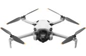
DJI Mini 5 Pro
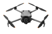
DJI Mavic 4 pro
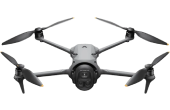
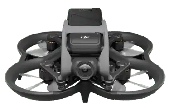
DJI Avata 2

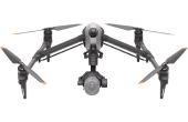
DJI Inspire 3
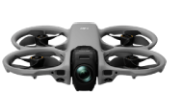
DJI Avata 360

Disclamer
The sample video you are currently watching is sourced from DJI's official promotional materials and are used strictly for informational and demonstration purposes only. Dazz Drones does not claim ownership of this media. All rights to the footage belong to DJI® (SZ DJI Technology Co., Ltd). Actual shoot results may vary based on drone model, location, pilot, and weather conditions. These videos are intended to help clients understand the visual capabilities of each DJI drone available for selection through the Dazz Drones platform.
Disclamer
The sample video you are currently watching is sourced from DJI's official promotional materials and are used strictly for informational and demonstration purposes only. Dazz Drones does not claim ownership of this media. All rights to the footage belong to DJI® (SZ DJI Technology Co., Ltd). Actual shoot results may vary based on drone model, location, pilot, and weather conditions. These videos are intended to help clients understand the visual capabilities of each DJI drone available for selection through the Dazz Drones platform.
Disclamer
The sample video you are currently watching is sourced from DJI's official promotional materials and are used strictly for informational and demonstration purposes only. Dazz Drones does not claim ownership of this media. All rights to the footage belong to DJI® (SZ DJI Technology Co., Ltd). Actual shoot results may vary based on drone model, location, pilot, and weather conditions. These videos are intended to help clients understand the visual capabilities of each DJI drone available for selection through the Dazz Drones platform.
Disclamer
The sample video you are currently watching is sourced from DJI's official promotional materials and are used strictly for informational and demonstration purposes only. Dazz Drones does not claim ownership of this media. All rights to the footage belong to DJI® (SZ DJI Technology Co., Ltd). Actual shoot results may vary based on drone model, location, pilot, and weather conditions. These videos are intended to help clients understand the visual capabilities of each DJI drone available for selection through the Dazz Drones platform.
Disclamer
The sample video you are currently watching is sourced from DJI's official promotional materials and are used strictly for informational and demonstration purposes only. Dazz Drones does not claim ownership of this media. All rights to the footage belong to DJI® (SZ DJI Technology Co., Ltd). Actual shoot results may vary based on drone model, location, pilot, and weather conditions. These videos are intended to help clients understand the visual capabilities of each DJI drone available for selection through the Dazz Drones platform.
Disclamer
The sample video you are currently watching is sourced from DJI's official promotional materials and are used strictly for informational and demonstration purposes only. Dazz Drones does not claim ownership of this media. All rights to the footage belong to DJI® (SZ DJI Technology Co., Ltd). Actual shoot results may vary based on drone model, location, pilot, and weather conditions. These videos are intended to help clients understand the visual capabilities of each DJI drone available for selection through the Dazz Drones platform
Privacy Policy
At Dazz Drones, we are committed to protecting your privacy and safeguarding the personal information you share with us. This Privacy Policy explains how we collect, use, store, share, and protect your information when you use the Dazz Drones website, mobile application, or any of our drone services.
Whether you are booking a drone shoot, requesting a quotation, scheduling a callback, submitting an enterprise inquiry, or contacting our support team, we are committed to handling your personal information responsibly, transparently, and in accordance with applicable data protection laws.
By accessing or using the Dazz Drones website, mobile application, or any of our services, you acknowledge that you have read and understood this Privacy Policy and agree to the collection and use of your information as described below.
If you do not agree with this Privacy Policy, please refrain from using our website, mobile application, or services.
This Privacy Policy applies to all users of the Dazz Drones platform, including individual customers, enterprise clients, business partners, and visitors to our website.
To provide safe, reliable, and professional drone services, Dazz Drones collects only the information necessary to process your requests, manage bookings, communicate with you, and improve our services.
1.1 Personal Information
When you use our website or mobile application, submit a booking request, schedule a callback, contact our team, or request enterprise services, we may collect the following personal information:
Full Name
Email Address
Phone Number
Company Name (for enterprise clients)
Industry (for enterprise inquiries)
Project Address
City, State, Country, and Postal Code
Preferred Booking Date & Time
Project Requirements or Notes
Any additional information voluntarily provided by you
We only collect the information necessary to provide the requested services.
1.2 Booking Information
When you submit a drone shoot request, we collect information required to prepare your quotation and manage your booking, including:
Drone Shoot Category
Preferred Drone Package (Standard or Premium)
Selected DJI Drone
Preferred Shoot Duration
Preferred Date & Time
Project Location
Project Address
Booking Notes or Special Instructions
This information helps us review your project requirements and prepare an accurate quotation.
1.3 Enterprise Inquiry Information
If you submit an Enterprise Inquiry, we may collect:
Company Name
Industry
Contact Person's Name
Official Business Email
Phone Number
Project Location
Business Address
Project Requirements
This information enables us to prepare customized enterprise drone solutions and quotations.
1.4 Schedule Callback Information
If you request a callback, we collect:
Name
Phone Number
Preferred Callback Date
Preferred Callback Time
This information is used solely to contact you regarding your inquiry or requested services.
1.5 Contact Form Information
When you contact us through our Contact Form, we may collect:
Name
Email Address
Phone Number
Address
Message
We use this information to respond to your questions, provide support, and communicate regarding your inquiry.
1.6 Location Information
To provide accurate drone services, we may collect your project location through:
Address entered during booking
Location selected on our website
GPS or device location (only if permission is granted)
Location information helps us:
Verify drone service availability
Perform airspace assessments
Plan operational logistics
Prepare project quotations
Assign suitable drone pilots
Your location is never collected without your permission where required by your device or browser.
1.7 Device Information
When you visit our website or mobile application, certain technical information may be collected automatically, including:
Device Type
Operating System
Browser Type
IP Address
Language Preference
Session Information
Pages Visited
Referral Source
Website Usage Statistics
This information helps improve website functionality, security, and user experience.
1.8 Media & Project Files
Depending on your project, you may choose to upload or share:
Images
Videos
Maps
Reference Materials
Site Plans
Other project-related documents
These files are used only for reviewing your project and delivering the requested services.
1.9 Payment Information
Dazz Drones does not store your credit card numbers, debit card details, banking credentials, UPI PINs, or other sensitive payment information.
Where applicable, payments are processed through secure payment methods or agreed payment arrangements.
We may retain transaction references, invoices, and payment confirmations solely for accounting, legal, and customer support purposes.
1.10 Information You Voluntarily Provide
You may voluntarily provide additional information while communicating with us through:
Email
Phone
Contact Forms
Booking Forms
Enterprise Inquiry Forms
Schedule Callback Requests
Any information you choose to share will only be used to assist you and provide the requested services.
Dazz Drones uses your information only for legitimate business purposes and to provide the services you request. We collect only the information necessary to deliver a safe, reliable, and professional drone service experience.
We may use your information for the following purposes:
2.1 Booking Management
We use your information to:
Process your drone shoot request.
Review your project requirements.
Prepare and send project quotations.
Confirm bookings.
Schedule drone operations.
Coordinate with our operations team and certified drone pilots.
2.2 Service Delivery
Your information helps us:
Plan and organize drone shoots.
Assign suitable drone pilots based on project requirements.
Coordinate scheduling and logistics.
Deliver completed drone Shoot footage and project files.
Provide post-shoot customer support.
2.3 Communication
We may contact you to:
Confirm your booking request.
Send project quotations.
Share booking updates.
Notify you about scheduling changes.
Provide Drone Pilot details before your scheduled drone Shoot.
Respond to customer support inquiries.
Answer questions related to your booking or project.
Communication may take place through email, phone calls, WhatsApp, or other approved communication channels.
2.4 Enterprise Services
For enterprise clients, we use the information provided to:
Review project requirements.
Prepare customized quotations.
Coordinate large-scale or multi-location drone operations.
Manage ongoing business communications.
Provide enterprise support.
2.5 Schedule Callback Requests
If you request a callback, we use your information to:
Contact you at your preferred date and time.
Discuss your project requirements.
Answer your questions.
Help you choose the most appropriate Drone Service for your project.
2.6 Customer Support
We use your information to:
Respond to inquiries.
Resolve technical or booking-related issues.
Handle complaints or feedback.
Improve customer satisfaction.
2.7 Website Improvement
We may use anonymous or aggregated usage information to:
Improve website performance.
Enhance user experience.
Identify technical issues.
Optimize navigation and booking workflows.
Analyze website traffic and visitor behavior.
This information does not personally identify you.
2.8 Security & Fraud Prevention
We use your information to help:
Protect our website and systems.
Detect unauthorized activity.
Prevent fraudulent bookings.
Verify customer requests when necessary.
Maintain the security of our services.
2.9 Legal & Regulatory Compliance
We may process your information where necessary to:
Comply with applicable laws and regulations.
Respond to lawful requests from government or regulatory authorities.
Protect our legal rights.
Resolve disputes.
Enforce our Terms & Conditions.
2.10 Service Communications
We may occasionally send important service-related communications, including:
Booking confirmations.
Quotation updates.
Project status notifications.
Schedule changes.
Service announcements.
Policy updates affecting your booking.
Dazz Drones respects your privacy and does not sell, rent, or trade your personal information to third parties for marketing purposes.
We may share your information only in the following circumstances:
3.1 Certified Drone Pilots
Your project information may be shared with the certified drone pilot assigned to your booking, but only to the extent necessary to complete the requested services.
3.2 Service Providers
We may share limited information with trusted third-party service providers who assist us with:
Website hosting.
Cloud storage.
Communication services.
Payment processing.
Customer support.
Business operations.
These providers are permitted to use your information only for the services they perform on our behalf.
3.3 Legal Requirements
We may disclose information where required by applicable law, court order, legal process, or governmental authority.
3.4 Business Transfers
If Dazz Drones undergoes a merger, acquisition, business restructuring, or sale of assets, customer information may be transferred as part of that transaction, subject to applicable privacy laws.
3.5 With Your Consent
We may share your information for purposes not covered by this Privacy Policy only after obtaining your consent, where required by law.
3.6 No Sale of Personal Information
Dazz Drones does not sell your personal information to advertisers, data brokers, or unrelated third parties.
Dazz Drones uses cookies and similar technologies to improve your browsing experience and website performance.
Cookies may be used to:
Remember your preferred language and country.
Remember your selected currency.
Save Booking preferences during your session.
Improve website functionality.
Analyze website traffic and performance.
Detect technical issues and improve security.
You can disable cookies through your browser settings; however, some features of the website may not function correctly.
We retain your personal information only for as long as necessary to:
Provide requested services.
Complete Drone Shoot Bookings.
Deliver project files.
Meet legal and regulatory obligations.
Resolve disputes.
Maintain business records.
When your information is no longer required, it will be securely deleted or anonymized in accordance with our internal data retention policies.
Protecting your information is important to us.
Dazz Drones implements appropriate technical and organizational security measures, including:
Secure cloud storage.
Encrypted data transmission where applicable.
Access controls for authorized personnel.
Regular security monitoring.
Secure backup procedures.
While we strive to protect your information, no method of electronic storage or internet transmission can be guaranteed to be 100% secure.
Dazz Drones operates across multiple countries and may process your information in different jurisdictions where our services are available.
By using our services, you acknowledge that your information may be transferred, processed, and stored in countries other than your own, in accordance with applicable data protection laws.
We take appropriate measures to ensure your personal information remains protected regardless of where it is processed.
Depending on your location and applicable laws, you may have the right to:
Request access to your personal information.
Request correction of inaccurate information.
Request deletion of your personal information where legally permitted.
Request restriction of processing.
Object to certain processing activities.
Withdraw consent where processing is based on your consent.
Request a copy of the personal information you have provided.
To exercise any of these rights, please contact us using the contact details provided below.
Our website may integrate trusted third-party services to support our operations, including:
Website hosting providers.
Cloud storage providers.
Analytics services.
Mapping and location services.
Communication platforms.
Payment processing providers.
Each third-party provider is responsible for handling information in accordance with its own privacy practices.
Dazz Drones services are not intended for children under the age required by applicable law to provide valid consent in their jurisdiction.
If you believe that a child has provided us with personal information, please contact us so that we can take appropriate action.
We may update this Privacy Policy from time to time to reflect changes in our services, legal requirements, or operational practices.
Any updates will be published on this page together with the revised Last Updated date.
We encourage users to review this Privacy Policy periodically to stay informed about how we protect their information.
If you have any questions about this Privacy Policy or the way your personal information is handled, please contact us.
Dazz Drones
Email: support@dazzdrones.com
For general inquiries, enterprise projects, or privacy-related requests, our team will be happy to assist you.
Terms and Conditions
Please read these Terms and Conditions carefully before using the Dazz Drones mobile application or website ("Dazz Drones App & Web"). By accessing or using any part of the Dazz Drones App & Web, you agree to be bound by these Terms and Conditions. If you do not agree with any part of these terms, please refrain from using our services.
1.1 Dazz Drones App & Web allows users to request professional drone shoot services delivered by certified drone pilots.
1.2 Submitting a Booking request does not guarantee confirmation. All Bookings are subject to service availability, operational feasibility, and airspace regulations.
1.3 After receiving your Booking request, our team will review the project details and provide a quotation via email or WhatsApp, typically within 3-6 business hours.
1.4 A Booking is considered confirmed only after:
The quotation has been accepted by the client.
Any required payment has been successfully completed (where applicable).
An official confirmation has been issued by Dazz Drones.
1.5 Additional services, extended shoot duration, travel outside the standard service area, or project modifications may result in additional charges.
2.1 All quotations are prepared based on the information provided by the client.
2.2 Displayed pricing on the website represents standard service packages. Final pricing may vary depending on project location, duration, equipment requirements, permissions, weather conditions, and other operational factors.
2.3 All quotations remain valid only for the period specified in the quotation.
3.1 Dazz Drones does not collect payment automatically at the time a Booking request is submitted.
3.2 Payment instructions will be provided after the quotation has been approved.
3.3 Depending on the project, payment may be collected at the stage specified in your Quotation.
Before the scheduled drone shoot,
At the project location,
Or immediately after the shoot,
as communicated during the quotation process.
3.4 For remote or international projects, secure online payment links may be shared through email or WhatsApp.
3.5 Final deliverables may be withheld until full payment has been received.
4.1 Clients may cancel a Booking before confirmation without any cancellation charges.
4.2 Cancellations made after Booking confirmation may incur cancellation fees depending on the project stage and operational costs already incurred.
4.3 Refund requests are reviewed individually based on:
Booking status
Payment status
Work completed
Operational expenses
4.4 If Dazz Drones cancels a confirmed Booking due to operational reasons, weather, pilot availability, or regulatory restrictions, clients will be offered rescheduling or an eligible refund where applicable.
5.1 All drone operations are subject to weather conditions and local aviation regulations.
5.2 Dazz Drones reserves the right to postpone or reschedule Drone Shoots due to:
Unsafe weather conditions
Government restrictions
No-Fly Zones
Airspace restrictions
Safety concerns
5.3 Clients are encouraged to check the Drone Flight Zone for their selected location before submitting a Booking request.
5.4 Project schedules may change if regulatory approvals are delayed or denied.
6.1 Pilot assignment begins only after the Booking has been officially confirmed.
6.2 Pilot details are generally shared 6-24 hours before the scheduled Drone Shoot, depending on operational requirements.
6.3 Dazz Drones reserves the right to replace an assigned pilot if necessary without affecting the agreed scope of work.
7.1 Clients are responsible for ensuring site accessibility and providing accurate project information.
7.2 The designated client representative should be available during the scheduled Drone Shoot.
7.3 Final deliverables will be provided after completion of the Drone Shoot according to the agreed project scope.
7.4 Footage may be delivered:
Through Google Drive,
Secure online download,
Or another agreed digital delivery method.
7.5 Delivery timelines may vary depending on project complexity, operational requirements, and any additional editing services requested.
8.1 Basic deliverables are provided as agreed in the quotation.
8.2 Professional editing, color grading, motion graphics, or additional revisions may incur extra charges.
8.3 Editing timelines depend on project size and complexity.
9.1 All captured footage remains the property of Dazz Drones until full payment has been received.
9.2 Upon full payment, ownership and usage rights of the agreed deliverables are transferred to the client unless otherwise specified in writing.
9.3 Dazz Drones may use project images or footage for marketing purposes unless the client has requested confidentiality before the shoot.
10.1 Dazz Drones is not liable for delays or cancellations caused by weather conditions, regulatory authorities, airspace restrictions, natural disasters, or other circumstances beyond reasonable control.
10.2 Clients are responsible for obtaining any permissions required for access to private property unless otherwise agreed.
10.3 Clients are responsible for providing accurate project information. Dazz Drones shall not be responsible for delays resulting from incorrect or incomplete information.
11.1 Personal information collected through the Dazz Drones App & Web is handled in accordance with our Privacy Policy.
11.2 Client information is used solely for Booking management, communication, operational support, and service delivery.
Dazz Drones reserves the right to modify service offerings, pricing, operational procedures, and these Terms and Conditions at any time without prior notice. The latest version published on the website shall apply.
For any questions regarding these Terms and Conditions, please contact us:
Email: support@dazzdrones.com










.webp)
.webp)